
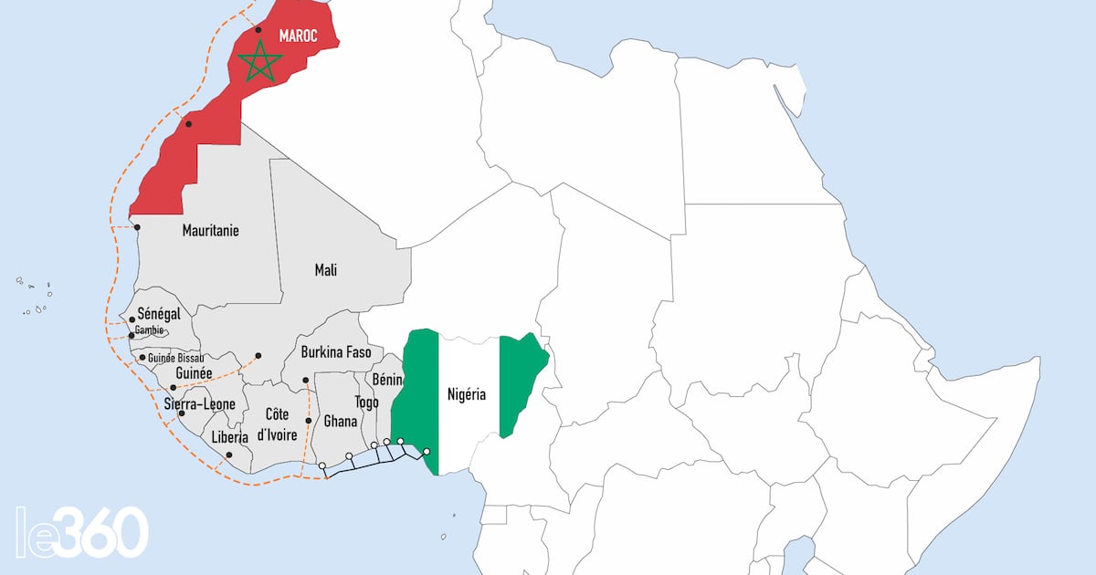
The Nigeria-Maroc gas pipeline project is advancing to a critical phase as topographic surveys commence along the northern segment, spanning Morocco, Mauritania, and Senegal.
Etafat, a Moroccan engineering and surveying firm—and a subsidiary of the French group Parera—has initiated aerial mapping and ground-level assessments following a coordination meeting with representatives from Morocco’s National Office of Hydrocarbons and Mines (ONHYM) and Nigeria’s National Petroleum Company (NNPC).

The surveys, which will also evaluate geological and geotechnical conditions, are slated to continue until spring 2025, according to Stéphane Ciesielski, International Operations Director at Fondasol, a French partner in the initiative.
Land-based surveys present greater challenges than offshore assessments
Energy analyst Amin Bennouna highlights the complexity of terrestrial surveys, which extend beyond technical feasibility to include logistical factors such as road access, urban expansion zones, and land ownership. «These studies must map not only technical constraints but also infrastructure accessibility and property boundaries to identify the most viable pipeline route», he explains.
Spanning 5,600 kilometers and estimated at $25 billion, the pipeline will originate in Nigeria and traverse 13 West African nations before terminating in Morocco, where it will link to the Maghreb-Europe Gas Pipeline and Europe’s broader gas network.